The Caribou Eskimos/Part 1/Chapter 1
Situation and boundaries. At the mouth of Nelson River the forest is by no means what it is further south, but still it is fairly luxuriant. Where Churchill River empties into Hudson Bay a little below lat. 59° N. it is, however, clearly approaching the end. Flat, swampy stretches and naked clumps of rock everywhere contest its existence, and in the sheltered depressions, where Jens Munk's men found timber enough for building houses, there are for the most part only dead stumps left, and no new forest has grown up. Following the coast of Hudson Bay north of Churchill the forest can still be seen describing a dark line some way inland up to Hubbart Point. Here the timber line stretches to the northwest, running south of Thlewiaza River, across the lakes Nueltin and Ennadai and cutting Lake Boyd just below lat. 61° 30' N.[1] From there it continues towards the northwest, south about the lakes Tyrrell and Campbell, across Artillery Lake in lat. 63° N. and onwards, south about Clinton Golden and Aylmer Lakes.[2] Here, however, we are far to the west of the Caribou Eskimo territory.
The timber line may be regarded as the most southerly boundary of the Eskimos in these regions. They look upon the forest as being something living, full of magic and weirdness, and no one dares to pitch a tent for more than ten days among trees. At one or two places close to the timber line trading posts have now been established, and they will undoubtedly attract the Eskimos; but even in the most southerly part of the Barren Grounds they formerly moved only with caution, for until a few years ago their hereditary enemies, the Chipewyan Indians, regularly made hunting trips even well up towards the north, for instance to the region round Hikoligjuaq. The Chipewyan round Churchill and Reindeer Lake have almost just as great a superstitious fear of living under trees in summer as the Eskimos.
Northwest of Lake Boyd and Dubawnt River there are still extensive Barren Grounds, but west of long. 100° W., where the Dubawnt and Thelon rivers meet, Eskimos seldom, or never, live. Hanbury met with the most westerly Eskimos at Tibjalik or Beverley Lake and writes about them: "On the main Ark-i-līnik River there is a stretch of country about eighty miles in length into which no human being enters. The Eskimo do not hunt so far west, and Yellow Knives and Dog Ribs from Slave Lake do not go so far east".[3] The Barren Grounds continue, gradually poorer and more wasted, northwards right to the Arctic Sea; but neither do the Caribou Eskimos here go right to their boundary. At upper Back River the Yellow Knives do not extend their hunting beyond Musk-ox Lake, and it was only a little above Lake Beechey that Warburton Pike found traces of Eskimos.[4] As from this place an easily passable valley leads in the direction of Bathurst Inlet, and as among the Eskimo remains found there was a piece of copper and also several pieces of sealskin, the natural assumption is that the inhabitants of the camp were Copper Eskimos. The middle and lower part of Back River belong to another group of tribes, the most famous of which is the Netsilingmiut. It has previously been the general opinion that the natives whom James Anderson met at this river were Caribou Eskimos, as they lived up country and were in possession of various European objects which must have. come from Churchill.[5] This belief, plausible enough in itself, is wrong, however. The tribes living at Back River, i. e. the Utkuhigjalingmiut and Háningajormiut, have in many respects an inland culture and trade regularly with the Caribou Eskimos; but these latter are not known to have ever extended their territory so far towards the north. Roughly, lat. 65° N., or the watershed between Back River on one side and Thelon River-Baker Lake on the other, may be put as the boundary, and this continues eastwards as the boundary towards the Aivilingmiut, running inside of Wager Inlet to the mouth of Chesterfield Inlet in lat. 63° 30' N. (approximately). Thus the whole territory lies to the south of the Arctic circle.
The most natural of the boundaries — except of course the seacoast — is the timber line in the south, where nature entirely changes and creates other conditions of life. The watershed in the north is so far also a natural line, as it agrees with the inclination of the Eskimos. to group themselves about watercourses and lakes. The boundary on the west is quite different. Here it is neither the geography of the country nor a strange population which marks the barrier, but simply the smallness of number of the Caribou Eskimos themselves. It is
 Fig. 1.The Hudson's Bay Company's trading post at the mouth of Chesterfield Inlet. Behind the Company's buildings the Catholic Mission and far in the back-ground the barracks of the R. Canadian Mounted Police.
human life that ebbs out and creates one of those voids that are characteristic of thinly populated countries.[6]
Fig. 1.The Hudson's Bay Company's trading post at the mouth of Chesterfield Inlet. Behind the Company's buildings the Catholic Mission and far in the back-ground the barracks of the R. Canadian Mounted Police.
human life that ebbs out and creates one of those voids that are characteristic of thinly populated countries.[6]
Situation and the penetration of civilisation. In the course of fourteen days we are now taken from the world's greatest wheat market in the centre of the most crass, commercial present to the relic of a past almost as primitive as that in which our forefathers lived five thousand years ago. That which is geographically interesting in this contrast is the circumstance that it is due to the difference in situation. In the Barren Grounds of the Caribou Eskimos we are on the threshold of the oecumene; one more step, and we are in the midst of the uninhabited Arctic waste. The contrast, however, is extremely instable and is only maintained because Canada's own colonisation is so young. In our day "l'isolement est une anomalie qui semble un défi"[7]. For better or worse the Eskimo will increasingly feel that the white man is upon him.
The first step has already been taken, even if we disregard the slight contact which the establishment of the Hudson's Bay Company's post at Churchill has meant. When the Fifth Thule Expedition stayed among the Caribou Eskimos, similar posts were found at Chesterfield Inlet, dating from 1912 (fig. 1), at Baker Lake from a few years later, at Eskimo Point since 1921, and at Ennadai Lake. At Nueltin Lake the Révillon Frères established a post in 1922. For a year or two the firm of Lamson & Hubbard also had posts at Chesterfield Inlet and Baker Lake. These have now been abandoned, but the Hudson's Bay Company has made a new advance, and, if the railway to Hudson Bay is built, whether it be from Winnipeg or the more problematical connection with Great Slave Lake, the speed will be increased even more. At Chesterfield a detachment of the Royal Canadian Mounted Police are also stationed, and there is a Catholic Mission under the leadership of Mgr. A. Turquetil, O. I. M.
Intercourse with the whalers was of another nature, particularly because it only comprised one of the Caribou Eskimo tribes, the Qaernermiut or "Kinipetu", who in fact owe this meaningless name to the whaler jargon. It was Rae's expedition which drew the attention of the public to the chances in Hudson Bay, and in 1860 the first American whalers made their appearance in the northwest of the Bay.[8] The Americans from New Bedford and adjacent ports took the lead in these virgin waters, whilst the Scottish whaler fleet kept to the old grounds in Baffin Bay and Lancaster Sound. The American methods were very different to those of the Scots, and this difference was of extreme importance to the Eskimos. The ships were fitted out for wintering once or twice, and this usually took place at Marble Island, Fullerton, Whale Point or Repulse Bay. Immediately a ship arrived at the coast, a number of Eskimo families were employed. These were mostly Aivilingmiut, although some Qaernermiut also entered the service. In the winter the natives hunted seal, caribou and musk-ox for the purpose of supplying the ship with fresh meat, and during the “open period" they helped to man the boats. In contrast to the Scots, the Americans did not use their ships for whaling, but cruised with whale-boats in Roe's Welcome from May until the beginning of September.
In this manner the Eskimos learned to steer a sailing boat, and the use of the kayak in the hunting of aquatic mammals was forgotten. In other ways, too, the influence of the whites was felt. Thus among the Aivilingmiut there are several half-breeds, whereas there are only very few among the Caribou Eskimos. Many of the white man's necessaries found a footing among the natives. Although the crews of the whalers were a remarkable medley of scrapings, often shanghai'ed and as a rule without the slightest knowledge of seamanship, contact with them has been less fateful than might have been expected. Alcohol has never obtained a footing in these regions. There are some cases of venereal disease among the Aivilingmiut, but the Caribou Eskimos are practically untouched by it. One of the few Scottish whalers in the Bay used to engage the Eskimos from Big Island in Hudson Strait and bring them back there in the autumn. Thus they came in contact with the population east of Hudson Bay (one Baffinlander had settled at Repulse Bay and was still living there in 1923), from whom they learned to read and write the syllabic alphabet introduced by the Rev. Peck. The knowledge of this is now widespread, though much more among the Aivilingmiut and Iglulingmiut than among the Caribou Eskimos.
Whaling in these waters culminated as early as about the year 1870.[9] Thereafter it gradually fell off and since 1900 only few whalers have wintered there. It is now several years since any were seen. One of the last was the experienced and popular Captain Geo. Comer who, through his observations and collections, has rendered great service to science.
Situation and the pre-Columbian oecumene. If we are to explain the conditions of culture of the Caribou Eskimos from the situation, we must, however, disregard the penetration of our civilisation in post-Columbian times. It is the conditions as they were prior to 1492 that have left the deepest traces in these regions. The circumpolar culture region is a unity, not only in virtue of the homogeneous geographic surroundings, but also as a consequence of ancient cultural connection. In this series of development the Eskimo culture occupies its well defined place, characterised just as much by its holding on to certain old elements as by its extremely peculiar and specialised new development. Many of its elements must be assumed to be independent and to have appeared as a consequence of a primary adaptation to the peculiar environment.
Such a specialised form of culture is exacting. It is very selective towards the foreign influences which seek to leave their mark and does not uncritically absorb every element that comes along. Naturally there are, besides the elements that owe their existence solely to the geographical conditions, many others which are due to borrowing from other peoples. Whether these are pure acquisitions or, in being  Fig. 2.Harvaqtôrmiut from a camp at lower Kazan River where women and children had never before seen white men.
incorporated, they have provided the impulse for a new kind of secondary adaptation, in this case it is the geographical situation of the Eskimo culture, its access to intercourse with outside forms of culture, that is determinative. Its remoteness of situation from the great centres of civilisation in southern México and Guatemala on the one hand and China on the other has already been pointed out previously.[10] Boas describes how the culture waves from the American Mediterranean are felt weaker and weaker the farther north one comes in America,[11] and the strip of Arctic coast which the Eskimos call their home is undoubtedly outside the extreme wave line. Asia has been of greater significance and, although I am unable to agree with Steensby in his hypothesis of the dependence of the Eskimo culture upon Japan, it must be admitted that to a certain extent he has been on the right track. The greater importance of East Asia to the Eskimos was not only due to the high age of its culture as compared with that of México, but to geographical conditions too. That chain of border seas known as the Sea of Japan, the Sea of Okhotsk and the Bering Sea with their island-arcs forms the bridge of an ancient culture road which cuts across one of the corners of the Eskimo region. A third culture source, the wealth of which cannot compare with either that of East Asia or that of México, but which perhaps on account of its nearness may have been of still greater significance, arose on the North Pacific coast. Its productive influence upon the Alaskan Eskimos is well known,[12] but certain lines can be traced even further out.
Fig. 2.Harvaqtôrmiut from a camp at lower Kazan River where women and children had never before seen white men.
incorporated, they have provided the impulse for a new kind of secondary adaptation, in this case it is the geographical situation of the Eskimo culture, its access to intercourse with outside forms of culture, that is determinative. Its remoteness of situation from the great centres of civilisation in southern México and Guatemala on the one hand and China on the other has already been pointed out previously.[10] Boas describes how the culture waves from the American Mediterranean are felt weaker and weaker the farther north one comes in America,[11] and the strip of Arctic coast which the Eskimos call their home is undoubtedly outside the extreme wave line. Asia has been of greater significance and, although I am unable to agree with Steensby in his hypothesis of the dependence of the Eskimo culture upon Japan, it must be admitted that to a certain extent he has been on the right track. The greater importance of East Asia to the Eskimos was not only due to the high age of its culture as compared with that of México, but to geographical conditions too. That chain of border seas known as the Sea of Japan, the Sea of Okhotsk and the Bering Sea with their island-arcs forms the bridge of an ancient culture road which cuts across one of the corners of the Eskimo region. A third culture source, the wealth of which cannot compare with either that of East Asia or that of México, but which perhaps on account of its nearness may have been of still greater significance, arose on the North Pacific coast. Its productive influence upon the Alaskan Eskimos is well known,[12] but certain lines can be traced even further out.
The remarkable littoral diffusion of the Eskimos has often been pointed out. Only in two places within the whole of their territory do they become inland dwellers: in Alaska and on the Barren Grounds. In Alaska, in the swampy stretches between the Kuskokwim delta and Bristol Bay, there live Eskimos of whom some members of the same tribe keep to the coast, others to the interior.[13] Farther north in Alaska we meet inland Eskimos living in the interior around the Noatak and Colville rivers. On the Barren Grounds Back River and also Caribou Eskimos have their hunting grounds.[14] As conditions are to-day, there is a great difference between these groups, however. The Kuskokwim tribes are to a certain degree influenced by their Athapaskan neighbours — for instance they use bark canoes — and seem to be a specialised fisher people who, however, are not without contact with the coast. Like the Colville Eskimos too, they were dependent upon their kinsmen at the coast, of whom they purchased blubber, seal thongs and walrus skin for covering their boats.[15] The Back River Eskimos themselves say that they have only recently become inland dwellers for the sake of fox trapping, whereas up to a few years ago they hunted seal on the winter ice.[16] In contrast to all the others the Caribou Eskimos are in every respect an inland people, apart from the fact that a third of them every year come down to the sea. The products of the sea are a welcome, but by no means necessary addition in their daily life.
Of all central groups, none are more central than the Caribou Eskimos. To the north they are in immediate touch with at least two other tribal groups: the Aivilingmiut at Roe's Welcome, who represent the Iglulik group, the Utkuhigjalingmiut and the Háningajormiut at Back River, belonging to the Netsilik group. Since a large number of the Arviligjuarmiut from Pelly Bay have immigrated into the Aivilik territory, the Caribou Eskimos have also come into connection with them, some Arviligjuarmiut now living so far south as at Depot Island, off Winchester Inlet. The Caribou Eskimos have also frequently met the Copper Eskimos when the latter have travelled southwards from Bathurst Inlet and Ogden Bay to Thelon River to fetch timber and to trade.[17]
If the Caribou Eskimos have ever had any connection with the Yellow Knives and Dogribs it has — at any rate as matters are now — been accidental and without significance. It is otherwise with the Chipewyan. The territories of this tribe and the Caribou Eskimos overlap on the southern Barren Grounds. It is true that it was the rule to avoid each other, and this principle was mostly only departed from, when one of the sides felt strong enough to make a victorious attack; but the contact has at times led to peaceful trading.
Thus from a casual observation there would seem to be all conditions in favour of the Caribou Eskimos, in close contact with kinsmen and Indians, being able to develop a relatively high culture. This is not, however, the case. For all the conditions have not been fulfilled simply because the situation in itself is good, not even when it is supported by commercial demands. Water and oil will not blend, and Vidal de la Blache has rightly pointed out that a certain uniformity — or perhaps rather an inclination to develop according to certain uniform lines — is vital to profitable intercourse.[18]
Now the development of the Eskimo culture is marked by an increasing adaptation to the sea. It culminates in southern Alaska in the west, at Angmagssalik in the east. There live those "sea centaurs" — as the Russians call the Aleut — whose hunting of aquatic mammals forms the material foundation of a refined ornamentation, an impressive poetry, and a peculiarly drawn-up religion. The Eskimos have never, however, taken the "continental" side of their culture to any considerable height. What the peoples by the Northwest Passage and Hudson Bay possess in the form of higher culture is for the most part so closely connected with aquatic mammal culture that for this reason alone it was impossible that it could be absorbed by the inland tribes. With this the question is not entirely exhausted, however. There is also the consideration of purely historic facts concerning the mutual relationship of the Caribou Eskimos and the other Central tribes, the direction of their wanderings, and so on, all matters which can better be discussed in conjunction with the problem of their cultural position as a whole. What interests us at present is merely that the situation has also played a part in this connection and, what is more, it is a different part to that which might be expected after a casual observation.
From the point of view of culture the sub-arctic Indians have more points of contact with the Caribou Eskimos than with any other Eskimos, first and foremost because the forms of culture of both are independent of the sea and based upon caribou hunting on a large scale. From a geographical point of view, however, there is a fundamental difference between them, the former being adapted to the sub-arctic forests with loose, deep winter snow, whereas the latter belongs to the open Barren Grounds, where as a rule the snow is as firm as a floor. Some Indian culture elements have found their way to the Caribou Eskimos, but they are so few that their number more nearly causes surprise. Many more might very well have been absorbed without this being prohibited by the geography of the country. We are therefore hardly in error in seeking the explanation of this not so much in geography but in history. Only at a very late date. did the group of Chipewyan with which the Caribou Eskimos are in contact, the so-called Etthen-eldeli or "Caribou Eaters". penetrate from the Mackenzie area to their present hunting grounds. One of the principal causes of their being allured so far east as Churchill River was the building of Fort Prince of Wales.[19] For this reason the contact, which moreover has oftenest been of a warlike character, has meant less than if it had been of earlier date. Before the Chipewyan got as far as to Hudson Bay, the Cree territory stretched right over to Churchill. The Cree have scarcely extended their hunting trips to the Barren Grounds proper to the same degree as the Chipewyan;[20] but they have had a longer time to work in. It is significant that in the few cases in which an Indian influence in the culture of the Caribou Eskimos can be traced to a certain tribe, it is to the Cree and not to the Chipewyan. This will be dealt with further in the analytical section.
All in all, the Caribou Eskimos have, despite the central situation of their country, remained remarkably isolated throughout time. On the one side they had tribes to which they were closely related in language and race, but whose culture they could only partly benefit from — on the other side nations from which they felt themselves so different in most respects that the tension between them oftenest developed into a state of belligerency. On the west great, uninhabited stretches which were seldom or never livened up by a camp fire — on the east the billows of Hudson Bay. A remote spot off the path of the culture drift, well suited for the retention and preservation of an old type of culture.
Physiography. Suess has compared the shallow Hudson Bay and the surrounding country with the Baltic transgression and Fennoscandia. The peninsula of Labrador in many respects is a counterpart of Scandinavia, whilst the Barren Grounds occupy the place of Finland.[21] This comparison is applicable on most points in geomorphology. It is the situation on the globe and the consequent differences of climate, vegetation and history, that have brought about the fundamental difference as regards human geography.
In contradistinction to those of Europe, the leading features in the topography of North America run from north to south. The main features are the contrast between the mountains along the coasts of the Pacific and Atlantic, and the continental depression between them. Crossing this division runs a geological division which, to the northeast and north, separates the so-called Canadian shield and the regions which have been covered with ice in pleistocene times. The situation of the Barren Grounds as the northwest corner of the Canadian shield therefore at the same time characterises this region as a low, once ice-covered land principally built up of pre-Cambrian rock.
In particular J. B. Tyrrell's work has given us detailed information as to the geology and physiography of this region, and the few observations that are due to other travellers, or which I have myself had an opportunity of making at places off Tyrrell's routes, closely agree with his investigations and show extraordinarily great uniformity. The foundations of the country consist of grey or lightred gneiss, granite-gneiss, or granite, which are classified as Laurentian. At the coast between Rankin and Dawson Inlet there are dark, crystalline schists and plutonic rocks as well as light quartzite of Huronian age, while similar rocks are also to be found at several places in the interior. However, the determination of age is everywhere very uncertain.[22] Soapstone, which the Eskimos make into lamps and cooking pots, is to be found a little to the north of the Caribou Eskimo territory between Wager Inlet and Boothia Peninsula,[23] by Lake Thaolintoa in the interior,[24] and at Qiqertarjuaq and Rankin Inlet. J. B. Tyrrell discovered copper ore at several places among the Huronian rocks, but as it is chalcopyrite and not free metal, it is of course of no importance to the natives. The south side of Baker Lake is formed of a coarse, red sandstone, the southern boundary of which I found a few kilometres above the lake at Kazan River. Similar sandstone and conglomerates, which presumably date from Keweenawan,[25] are also known from the east side of Dubawnt Lake and Thelon River and are assumed to form a connected area. The Eskimos use the sandstone for skin scrapers, which also are traded among the neighbouring tribes to a rather wide extent.
In our day the land forms a slightly elevated peneplane, which in pleistocene times was the centre of the Keewatin inland ice and by this was turned into a rolling country with low relief, where rounded hills stretch up over flat, till-covered areas. Terminal moraines, eskers and drumlins provide further evidence of the glaciation. We can, however, differentiate between an inner plateau and a coastal plain.[26] The first stretches at an average height of a good 300 m to a line which runs northeast of the lakes Nejanilini, Angikuni and Dubawnt. Here the land merges smoothly into the coastal plain which, from about 200 m above the sea, sinks towards Hudson Bay and the Arctic Sea. In post-glacial times this part of the land has been inundated, and large areas are occupied by alluvium. There are rather big sand plains, and the valleys are filled with coast terraces. The coastal plain is much bigger than the inner plateau, and for that very reason if for no other, most of the Eskimos live on the plain.
The coast itself is low everywhere, with a gradually falling shelf outside. The northern part, where the land mostly consists of preCambrian rocks, is much indented, especially by the long narrow fjord Chesterfield Inlet and the shorter and broader Rankin Inlet. There are also several open bays dotted with islands, such as Pistol Bay and Mistake Bay. Of the islands only Marble Island, thus called after its white quartzite,[27] reaches a respectable size. South of Dawson Inlet the topography of the coast changes character; only rarely is a rock seen in situ, and great flat plains stretch everywhere down to the sea. From a distance the horizon line of the coast seems to have been drawn with a ruler. In some places, for instance at Eskimo Point, eskers from the interior stretch forward in the form of low sand-spits; there are hardly any islands — one of the few is Sentry Island, a continuation of the esker at Eskimo Point — and the coast water is so shallow that boulder reefs can be seen projecting above the surface at ebb at a distance of about ten kilometres from the shore. Apart from the Hudson's Bay Company posts at Chesterfield Inlet and Eskimo Point, there is not a single permanent settlement on the whole of this coast — a remarkable contrast to other Eskimo coasts.[28]
The former ice covering has everywhere created possibilities of an abundance of water. Two great river systems flow through the Barren Grounds, but of these Back River and its tributaries are outside the Caribou Eskimo area. The southern system comprises three rivers of almost equal length. Thelon from the west. Dubawnt and Kazan from the south, whose waters finally gather at Baker Lake and empty into Chesterfield Inlet. East of Kazan River there are only small rivers, such as Ferguson. Maguse, McConnell and Tha-anne running to Hudson Bay. The rejuvenating effect of the glaciation on the hydrography of the country has given the rivers a very turbulent character, sometimes frothing their way through narrow channels, broken by whirlpools and falls, then widening out into great, ramified broads (fig. 3). Innumerable lakes, the largest of which are Baker Lake, Dubawnt and Yathkyed or Hikoligjuaq, are spread over the country, and in the depressions, where rocky or icebound soil prevents the water from soaking away, the ground is swampy and filled with bogs. In summer the contrast between these saturated depressions
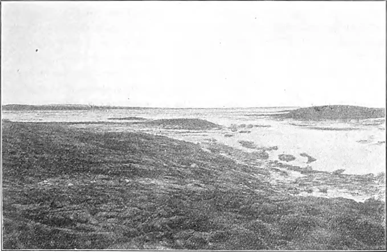 Fig. 3.Lower Kazan River at one of the great ice-filled lakes.
Photo taken July 1st.
and the bone-dry sand and gravel hills makes a striking difference in the vegetation. Rivers and lakes are the physiographic features which are of most importance to the diffusion of the Eskimos, the distribution of the settlements being directly dependent upon the abundance of fish in them and the places where the caribou cross them on their migrations.
Climate. Vahl has the honour of having found a formula for determining the climatic boundaries of the biochores, a formula that is logically more correct, and in practice gives better results, than the previously applied limitation by the use of isotherms. How the polar boundary will run in detail in the Barren Grounds is as yet beyond. our power to indicate;[29] but practically speaking the climate everywhere may be described as arctic. Shut off from the mild influence of the Pacific by the wall of the Cordilleras, but open to the north, both the Mackenzie basin and the Barren Grounds are left to the mercy of the polar winds which blow from that zone of barometric maximum which, like an "arctic wind-divide",[30] separates the minima over the northern Atlantic and the Pacific. Extreme cold, which on the Barren Grounds in January lies between 12° and 16° C. too low according to the latitude, prevails during the whole winter in this area.
And yet in the Mackenzie basin we find a climate that is quite different to that which prevails farther east. In four years out of five wheat ripens at Fort Simpson, a degree more to the north than Eskimo Point, and barley reaches up to the same latitude as Chesterfield Inlet.[31] The tremendous inland sea of Hudson Bay absorbs a large part of the drift ice from Foxe Channel and Fury and Hecla Strait, but permits neither this ice nor that formed in the bay itself to get out at any other point than through the narrow Hudson Strait in the northeastern corner. Thus the bay acts as a huge ice-house throughout the summer and is mainly responsible for the low summer temperatures which create the arctic climate over the Barren Grounds. Even in July the Bay is up to 4° too cold according to its situation, whereas the Mackenzie basin at the same time has a surplus of heat. The isanomal for 0° seems to run a little south of the timber line and parallel to it.
One of the variable factors which contribute towards determining the physical climate in the Arctic and which makes the study of it especially difficult, viz. the situation in proportion to the enormous accumulations of ice,[32] does not trouble us on the Barren Grounds. As a consequence of its situation in the extreme zone of the arctic region the climate on the whole closely approaches the cold temperate. In southern West Greenland there is another transitional zone between the arctic and the temperate belts, and yet there is a striking contrast between this region and the one here described. In southern West Greenland the weather is moist, subject to the influence of the ocean and with fairly mild winters. Over the Barren Grounds the wind blows most of the year from NW., so that between the bitterly cold winters and the cool summers we have an average annual amplitude of about 40° C. and simultaneously a very slight precipitation. This extremely continental character marks an approach to the climatic type of the Mackenzie basin.
Vegetation. Some day, when the flora in the Caribou Eskimo territory is sufficiently known, we will presumably again be able to trace the difference between isolated, oceanic South Greenland and the continental regions west of Hudson Bay. Thus one result of their situation is that in places the forest spreads beyond its proper climatic boundary to warm valleys where there is shelter from the keen, drying winds. It is the most easily satisfied and hardy trees, white spruce (Picea alba), black spruce (P. nigra) and American. larch (Larix americana) that form these extreme outposts of the sub-arctic forests in the south; but even they are practically only found on the inner plateau. Here at Thelon River, upper Dubawnt and upper Kazan, at Tha-anne River, in short along all the routes that are known, have been found such small clumps of trees that are of the very greatest value to the Eskimos.[33] With good snow they only need to travel "one sleep" with a dog sledge from Eskimo Point into the country south of Maguse River to get wood for sledge runners and tent poles, and the Eskimos at Hikoligjuaq fetch wood from the south side of the lake. Lower Thelon River brings down large quantities of drift-wood[34] which the Eskimos collect at Tibjalik Lake. On the shore of Hudson Bay, however, there is no drift-wood north of McConnell River owing to the currents.[35]
Some travellers have protested against the term Barren Grounds. In the same meaning as the Finnish-Russian term "tundra" the name is fully justified, but of course there is not the same scarcity of vegetation as in a desert (fig. 4). Almost naked portions, at the most with a sparce lichen vegetation, are only to be found on rocks and at the top of dry gravel hills. Otherwise the country is covered with lichen or bush heath which, in moist places, becomes meadow or luxuriant willow thicket. The most southerly band of the Caribou Eskimos is called after the many willows in its country. The arctic seed-plants disclose their adaptation to the conditions in a multitude of ways. Among Raunkiær's growth forms hemicryptophytes and chamæphytes show an unusually high percentage; but on this point, too, the Barren Grounds seem to be an arctic transitional zone, the chamaphytes as yet hardly being present in such large numbers as farther north.[36]
Both the various bushes, especially the very resinous Cassiope, and bush-lichens are much in use all the year round as fuel among the Eskimos who, with few exceptions, never cook over the blubber lamp.
Fauna. There is no doubt that South Greenland has a richer marine fauna than the shore of Hudson Bay. This is presumably especially true of the lower animals, and the trout is the only saltwater fish that is of any importance to the Eskimos on Barren Grounds, whereas the West Greenlanders have a rich selection of fish at their disposal. Cod and halibut have been sought for in vain in Hudson Bay.[37] To a smaller extent something similar is, perhaps, the case with the birds, but still there are many kinds of birds at the
 Fig. 4.Typical Barren Grounds scenery in early summer. Snow is still lying at the north foot of the hills.
Bay in summer. On the other hand the number of aquatic mammals is almost the same.[38]
Fig. 4.Typical Barren Grounds scenery in early summer. Snow is still lying at the north foot of the hills.
Bay in summer. On the other hand the number of aquatic mammals is almost the same.[38]
The polar bear (Ursus maritimus) comes on the drift ice from the north along the coast. It lands in great numbers on Southampton Island and is not rare in Roe's Welcome; but on the southwest coast of the Bay it hardly ever lands, so that the Eskimos there get fewer bears than the Chipewyan at Churchill. Whales, of which the white whale (Delphinapterus leucas) is very numerous in places, are not hunted at all by the Caribou Eskimos and, when some of them visit the coast every year, it is only for the purpose of hunting the walrus (Trichechus rosmarus), the bearded seal (Erignathus barbatus) and the fjord seal (Phoca foetida). These animals are common almost everywhere. The spotted seal (Ph. vitulina) is found in some places, and both this and the fjord seal travel up into the great Baker Lake, in the northern, deep part of which they have breathing holes in the ice in winter. The saddleback (Ph. groenlandica) is also to be found, but so far out to sea that the Eskimos have no benefit from it, and the bladdernose (Cystophora cristata) seems to be unknown. Furthermore, it must constantly be borne in mind that to the Caribou Eskimos the hunting of sea mammals is on the whole something quite different and subordinate to that of the other Eskimo tribes. Most of them have never even seen the sea. I have met grown men among them who have never seen a seal, and a middle-aged man from Baker Lake was no more sure of recognising a strip of polar bear skin with which my Polar Eskimo mittens were edged than that he cautiously enquired.
The Barren Grounds have the advantage, when we turn to the fauna of the land and the lakes. From the list of fresh-water fish and terrestrial animals alone geographers can read the continental situation of these regions, with free access from the south. Here they decidedly outstrip West Greenland which, with its three terrestrial mammals and few land birds and fresh-water fish, retires completely into the background. Of the permanent dwellers none have closer connections southwards than the fresh-water fish. The big rivers all rise on the other side of the timber line, and no demand of geographic adaptation has hindered their immigration. The most important fish to the inhabitants are various salmonides such as trout and species of the Coregonus and Thymallus genera. Other families also give their contribution to the fauna with species such as the pike (Esox lucius), ling (Lota maculosa), sucker (Catostomus catostomus), tullibee (Argyrosomus tullibee) etc.
In many ways birds and mammals show interesting adaptations to the surroundings. In certain respects they have biological features in common with the steppe animals, but to a still greater degree with the alpine fauna. The most outstanding difference is due to the arctic abundance of water in summer. Countless numbers of aquicole birds[39] then live by lakes and rivers; but in contrast to the more favoured regions, where they can find food all the year round, the arctic region is to many animals in winter a waterless desert in a biological sense. Only migratory birds can therefore cope with the conditions. The sparse vegetation provides sufficient food for only few kinds of terricole plant-eaters, and therefore the number of carnivorous species is also small.[40] On the other hand there is, even in winter, sufficient food under the snow for a limited number of individuals, and that the arctic is quite devoid of land animals in winter is a myth containing just about as much truth as the belief of the middle ages that everything was burned by the heat at the equator. None of the terricole species entirely desert the Barren Grounds, even during the most severe winter, although many caribou and ptarmigan individuals move southwards.[41]
There are many kinds of land birds which do not live in Greenland: the crane (Grus canadensis), rough-legged buzzard (Archibuteo lagopus), horned lark (Octocorys alpestris) and, first and foremost, the willow grouse (Lagopus salicetis) which, together with the rock ptarmigan (L. mutus var. rupestris) is the only bird that really means anything to the life of the Eskimos.
It is, however, among the terrestrial mammals that the situation of the country is reflected most clearly. If we imagine a journey from the Barren Grounds over the Arctic Archipelago, we see the species decline in number. This is not because the climate becomes worse. It is simply the etapes in their advance towards the north after the glacial period that are still marked. Occasionally a few forest animals stray far into the Barren Grounds, such as the lynx, red fox, etc., and in the winter of 1922–23 two moose (Alces americanus) were shot south of Chesterfield Inlet. The Eskimos were so unaccustomed to seeing these animals, however, that they hesitated to eat them. The Hudson Bay marmot (Spermophilus Parryi) represents a genus which, from its mode of living, really belongs to the outer arctic zone; its tracks, however, are seen in sandy places as far north as to Fury and Hecla Strait. It is sometimes eaten by the Eskimos. A sort of vole (Microtus sp.) is found near the timber line. The wolverine (Gulo luscus) appears everywhere on the Barren Grounds and is generally hated as a cache plunderer on a large scale.
Four animals which have only had occasion to migrate into northeast Greenland but are lacking in the southwest, are common in the Barren Grounds, viz. the lemming (perhaps several species), ermine (Mustela erminea), wolf (Canis lupus), and musk-ox (Ovibos moschatus). By serving as food for the fox the lemming is of indirect consequence to the life of the Eskimos. The wolves may at times become embarrassing and are killed in a number of ways; as far as I know, however, the Eskimos never eat their flesh and only use the skin as platform coverings. Formerly the musk-ox was an important animal to the hunter, its flesh being a coveted food, whilst skin, bones and horn were made use of in various ways. Originally it went as far south as almost to Churchill, and as late as in 1897 two stray individuals were seen between Churchill and York;[42] now, however, its territory is very restricted. It is mostly found west of Chesterfield Inlet and northwards to the coast of the Arctic Sea, whereas south of Chesterfield Inlet and Baker Lake it scarcely appears elsewhere than west of Hikoligjuaq. Twenty years ago it was still common at Baker Lake, and at the same time big herds were seen at Thelon River.[43] The musk-ox is now a strictly preserved animal everywhere in accordance with the Northwest Game Act. The Caribou Eskimos have learned this of the Royal Canadian Mounted Police and the Hudson's Bay Company and seem to conscientiously observe the regulation, which may only be broken in case of famine.
In common with southwest Greenland there is the Alpine hare (Lepus variabilis var. glacialis), the Arctic fox (Canis lagopus) and the caribou (Rangifer arcticus). The hares are not numerous, and they are not of much importance to the Eskimos. It is otherwise with the foxes, of which by far the most are white and only very few blue. Their importance is of recent date, however, and exclusively commercial. The Hudson's Bay Company encourage the Eskimos to hunt the fox, and to the company a good man is synonymous with a skilful trapper. It is not to be denied that by this means the life of the Eskimos is to some extent being led into a wrong path, which, however, is as yet less observable in the southern Barren Grounds than for instance among the Aivilik tribe. As was already stated in the introduction, the caribou is the axis on which everything turns in the existence of the Barren Grounds Eskimos. It is still present in incalculable herds and provides the population with practically everything they need. How this takes place will appear from the later chapters; for a description of the life of the Caribou Eskimos is at the same time a constant reference to the caribou itself and its products.
Autumn. The arctic summer makes its appearance suddenly, but winter arrives stealthily, almost imperceptibly. Autumn is a long transitional period. Even in the middle of August 1922 the flowers were dying off at the mouth of Chesterfield Inlet, and one could feel that indefinable something that is called "autumn in the air". In the course of September all the smaller lakes freeze over, and as early as the latter half of the month J. B. Tyrrell found the small lakes at Corbett Inlet covered with nine inches of ice.[44] Baker Lake is said to be entirely covered in November. The constant northwest and north winds, which last for three quarters of the year, make their appearance in the autumn with a series of violent gales; but the snowfall is slight. Only in the depressions does the snow accumulate, whereas all the hill tops and stony places, such as the raised beaches, are blown clear immediately. For this reason the first time it is possible to use the dog sledge is a rather dificult one, for it is necessary to incessantly keep on steering clear of stones which project above the snow; it is also a cold time, because the snow is not yet deep enough for the building of snow huts, so that it is often necessary to live in tents in more than –20° C.
Only the real winter dwellers of the country are now left. The migratory birds have gone southwards — last of all the snow bunting — and great herds of caribou have sought shelter in the forests to the south; many of them — perhaps most of them — do not leave the country at all, however. In the autumn the caribou is fattest and its flesh most appetising. Early in the autumn a layer of fat — la dépouille among the Canadian voyageurs — several centimetres thick covers the backs of the old bulls; but whilst their flesh quickly becomes uneatable owing to the rutting time in October, and thereafter they are quite skinny, the young bulls and cows grow fatter until winter sets in in earnest. Occasionally this season may be a hard one for the animals, when the frost comes again after a short thaw and turns the uppermost layer of snow into a sheet of ice, which is difficult for the caribou to scrape through.[45]
Winter. Winter appears very gradually. After every mild period the cold comes on again with renewed force and the snow grows almost imperceptibly in thickness. Now and then a furious storm rages, but a steady, heavy downfall of snow is rare. Sometimes, on the other hand, the snow falls lightly and, as none of it melts, its depth gradually becomes rather great. The constant north and northwest winds blow it as hard as a floor. Only the hill tops are never covered for long.
The really severe cold begins in December, but in the arctic countries it is never before February, or even March, that the coldest period arrives,[46] and on the Barren Grounds February is reckoned to be the coldest month. In the two winters I spent on Danish Island and at Repulse Bay we had in the first year the coldest period in the beginning of January, the next year in the beginning of March, both times periods with more than 50° of frost. At Chesterfield the day temperature at the end of February 1922 varied between about –45° and –18°, but as a rule remained between –40 and –30; the most severe cold was, however, as stated, already over for that year.[47] At the beginning of March there were no great changes in the temperature, but still it did not get lower than –41°. At Baker Lake the thermometer during the first half of April could still drop occasionally during the day to below –30°, but more often it remained at between –20° and –10° and at the end of the month a day temperature of between –10° and 0° was the rule. On the last day but one of April there was a brief hail shower with rain, which however soon went over to snow, and on the following day I noted the highest temperature of the month: +3°. With this the positive temperatures had by no means gained the upper hand, for all during May the thermometer for the most part remained below freezing point; winter had gone, however. It must be remarked that spring was generally regarded as being fourteen days late that year.
The mildest days in winter are of course those on which the sky is overcast and radiation least. Such days are exceptional, however. As a rule the red ball of the sun is seen day after day describing its short path over a clear, pale blue sky. where only occasional, light stratus clouds hover on the horizon. The country lies dazzlingly white. with blue shadows in the sun and some dark patches where steep rocky cliffs and wind-blown hill tops prevent the snow from settling. And the wind sweeps incessantly over this open land. Even in the coldest periods quite still days are rare. Steadily, only occasionally increasing to a gale, blow these north and northwest winds, whose insidious attacks are liable to cause frost-bite, but which nevertheless mean an inestimable advantage to travellers, as the snow thus drifts together. Almost every day the loose, floury snow whirls merrily over the already firm underlayer — just that light degree of drifting which the Polar Eskimos so aptly call "floor sweeping". The drifting can. however, increase to a furious, blinding chaos of snow in which one cannot see a hand before one, while simultaneously a piece of smiling, blue sky in the zenith tells that the storm is only raging just at the surface of the earth. At this time of the year the snow is in such a condition that it is possible to travel everywhere, which is further facilitated by the low relief which does not necessitate long detours. Nor is it necessary to seek long for suitable snow for snow huts.
On the fine days the stillness is sublime, but not depressing, because at times it is broken by a single sound: the rushing of the wind, the scream of a raven high up in the clear air, or at the coast a creaking and crashing of the pressure ridges of the tide belt. At first. glance the country may seem to be quite dead and stiffened with the cold. The consciousness of time and space vanishes: "On ne savait si on assistait à la création ou à la fin du monde". But for one who knows how to read "the lore of the Arctic" there are daily signs that life has not entirely disappeared. A number of animals have gone away, and the marmots presumably lie in their burrows dreaming of warmer days; but there are constant signs of life, for the arctic climate is too cold to encourage hibernation on a large scale.[48] Now and then one's path is crossed by the track of a lemming which has ventured out of its burrow under the snow, or by the holes with long intervals between them, betraying the supple leaps of the ermine. More rarely it is the easily recognisable tracks of the Polar hare; but most frequently of all it is that of the fox. The fox roams far afield, often right out on the sea ice, where his track on rare occasions crosses the tremendous imprints of the paws of a solitary, wandering bear, and of course winter is the trapping time for foxes. At the ice-edge or the current holes there are always eiders (Somateria mollissima and S. spectabilis), long-tailed ducks (Pagonetta glacialis), black guillemots (Cepphus mandtii), seals and, in some places, walruses.
Nor is the interior devoid of animals which may serve as food for an easily satisfied people. Rivers and lakes contain fish which are caught with a hook through holes in the ice. Some ptarmigan remain in the country all the winter, and the musk-ox is found at places from which it never goes far away. In this season the caribou make their way to the valleys where there is a little shelter and where, by means of their broad hoofs, they scrape through the snow down to the lichens beneath it. Caribou are almost always on the move up against the wind; only in thick snow-storms do they stand quietly, and then it is an easy matter to hunt them. As winter proceeds they become more and more lean. Not until the new year, after the antlers have been shed, do the bulls seem to get fatter, whereas the cows in calf continue to lose weight. Caribou meat in this season is nothing compared with that in the autumn, neither in nourishment nor taste. For this reason the Eskimos at this time of the year mostly live upon their stores of frozen and dried meat.
Only the wolverine and the wolf can be regarded as being noxious to human beings. The wolverines often plunder the Eskimo caches, for it is said to be easier to build a bearproof meat cache than one that is safe against the attacks of the wolverine. The harm done by the wolves is more indirect, as they hunt in packs near the caribou. It is seldom that they attack man, as they do not venture too near the dog teams of the settlements, even if they are not averse to snapping up a solitary, roaming dog. When most of the men had left Chesterfield with their dogs at the end of February 1922, the wolves sneaked about among the snow huts almost every evening after dark, and the Eskimos were afraid to let their children go out alone.
Spring. The snow bunting (Emberiza nivalis) is the first herald of spring, which often comes in hard frost long before there is any change to be observed on the landscape. On April 12, 1922, on a day when the temperature swung between –16° and –25°, the first snow bunting made its appearance at Baker Lake, and the next year it came to Fullerton on exactly the same date in about –27°. Other birds such as the Lappland bunting (Emberiza lapponica), the redpoll (Cannabina linaria), the horned lark (Octocorys alpestris), and the ptarmigan follow soon afterwards. The caribou from the south also begin to appear here and there, the cows in calf coming first. It is, however, still a month before spring appears in earnest. After the first thaw the Eskimos reckon that there will still be two periods of frost, the last one not until the caribou calves have been born (i. e. in June), and thus it may do considerable harm. The first of these spring frosts is, however, the best time for travelling. After the thaw the surface of the snow is almost turned into ice so that the going is excellent; it is so light that the journey can be continued all night long if necessary; caribou and ptarmigan have commenced to come, and on the sea ice there are seals, so that the question of food causes no difficulty. The drawbacks are the sharp light that is reflected from the snow fields and is apt to cause snow-blindness and a painful, sun-scorched face, and also the dryness of the air which causes the lips to split. The weather is often unsettled, with heavy snow storms, and on occasion there may be violent rain showers and thunder.
During the course of May the naked, brown patches on the hill tops grow in size, and for a short period these become the centres of all life. It is to them that the snow buntings, ptarmigan and other birds resort, and in the snow surrounding them there are labyrinths of hare and marmot tracks. Sledge journeys soon become impossible. for even where the snow is still lying it is soft and almost impassable.
Towards the end of May it often freezes during the day, and at night the temperature may fall to –10°; in the sun, however, it is warm. Much of the snow seems to evaporate directly, and over the snow patches the air quivers as on the hottest summer day. Cloudy weather is not rare, and in the evening a clammy fog often descends. By the coast the weather is perhaps a degree worse than inland. During almost the whole of May 1923 there was practically a continuous series of snow-storms on the stretch between Chesterfield and Eskimo Point. The soft, impassable snow, the overcast sky and the black, Huronian rocks which projected here and there, gave the landscape an uncommonly gloomy appearance — a land clad in funereal clothing.
By this time, however, spring is advancing with gigantic strides. The sap-green moss stands with spore-cases erect; crowberry, Cassiope, whortleberry and other evergreen bushes at once commence the work of the oncoming summer; dwarf-birch and willow are in bud. Gulls, terns, and jaegers appear on the shore and fly far in over the country to places where the ice is now disappearing from the current holes of the river. On the sea ice the fjord seal lies in crowds and basks in the sun. But nothing approaches the impression of swarming life which suddenly awakens even in over the waste tundra and forms such a contrast to the stillness of winter a month or two before. The cranes arrive, in numbers but only few at a time, and their distant "krorrk-krorrk" blends on quiet evenings with the melodious "a'anik" of the long-tailed duck. Snow geese (Anser hyperboreus), Hutchin's geese (A. canadensis var. Hutchinsii), mergansers (Mergus serrator), king eiders (Somateria spectabilis), great northern divers and loons (Colymbus glacialis and C. septentrionalis), phalaropes (Phalaropus fulicarius), sandpipers (Tringa fusicollis, etc.) and others make their way up here from the south. Rock ptarmigan and willow grouse appear in flights of hundreds; the bleating cackle of the former and the pheasant-like scream of the latter can be heard everywhere.
Caribou tracks cross and recross in the patches of snow, and small flocks of the animals can be seen at all times in the distance. When they move over the ridges in endless, multi-legged rows standing but blackly against the clear sky, it is as if one suddenly understood the primitive etchings of the Eskimos and the palæolithic art in the caves of France and Spain. Soon the cows with year-old calves and the young bulls begin to come. It is now easy for the Eskimos to catch animals, and the hunger of the late winter, when the autumn stores have been eaten up, is at an end. I will never forget the widespread joy at a small camp at Kazan River, when the inhabitants had obtained so many caribou "that we do not keep count of them" — nor the Homeric feast, consisting exclusively of boiled caribou heads, in which we participated.
Summer. How high the temperature usually rises in summer cannot say; but the mean temperature in June must be presumed to lie between +5° and +10°. July is always the warmest month in the Arctic, for in June an enormous amount of heat goes towards
 Fig. 5.Kazan River in the beginning of July. The river has flung huge blocks of ice on to the shore.
melting the ice and snow of winter, and the heat of the sun radiation decreases rapidly in August.[49] In the beginning of June there are still some days of frost. In summer the winds are softer and more variable than in the other seasons. July is said to be the calmest month. Rain accompanies southern and eastern winds, and some showers may come from the west; but on the whole there is not much rain in summer either. On the other hand fog sometimes appears on the coast. In June practically all snow disappears from the land, although drifts may lie in protected places until into August.
Fig. 5.Kazan River in the beginning of July. The river has flung huge blocks of ice on to the shore.
melting the ice and snow of winter, and the heat of the sun radiation decreases rapidly in August.[49] In the beginning of June there are still some days of frost. In summer the winds are softer and more variable than in the other seasons. July is said to be the calmest month. Rain accompanies southern and eastern winds, and some showers may come from the west; but on the whole there is not much rain in summer either. On the other hand fog sometimes appears on the coast. In June practically all snow disappears from the land, although drifts may lie in protected places until into August.
In June the rivers also become free (fig. 5). At the outlet of Kazan River in Baker Lake the loosened blocks of ice pile up like a wall, until at last the strain breaks it with a roar which, on calm days, can be heard for miles. To a smaller extent I saw this even a month later at several river-broads where the ice lay. Up against the big flakes lie innumerable, smaller blocks, screwed and packed together into ridges over which it is often a piece of hard work to drag the canoe. A big icefloe like this can suddenly split up into pieces, and twisting and bobbing, with a noise like distant thunder, all these uncountable pieces drive at a furious speed down towards the next block, to be ground to powder there. When this happens, it is best not to be in the way with the canoe! In contrast to the sub-arctic forests, the wealth of water of the Barren Grounds is in summer a hindrance to communication. Originally the Eskimos had not travelling boats and are only now beginning to purchase canoes of the Hudson's Bay Company; but it will be long before they learn to derive full advantage of the rivers.
On the sea and the lakes the ice still covers the surface. After the snow layer has melted and the water has percolated through the cracks, there is again a short period when the sledge going is splendid. The land water gradually increases and, on the southern part of the west coast of Hudson Bay, the ice vanishes about July 1st, but at Repulse Bay not until a month later. In the big lakes the ice cannot drift away, as there is only an outlet through the narrow channels of the rivers. Like strange anacronisms these white icefloes lie in the summer heat of the landscape. The ice drifts to and fro in the lakes until it is broken into smaller pieces by waves and wind; but not until the latter part of July — in some years even the beginning of August — can the H. B. C. coast boats sail from Baker Lake to Chesterfield.
In summer there are many seals on the ice, the result being that about a third of the Caribou Eskimos make their way to the sea between Chesterfield Inlet and McConnell River. A few more Eskimos come to the southern, alluvial coast than to the northern, rocky coast, but this is not the result of any geographic valuation of the coast. It is merely due to the numerical condition of the tribes, and in these we are dealing with such small figures that the slightest change may disturb the balance.
July is the mid-summer period. The night is only a brief twilight with fantastical violet cumulus clouds and a sky that in the north is a fiery yellow gleam of flame. The waste stretches boundlessly on the far horizon, with great, evenly rising plains and delicately drawn hills. The country is alive in the summer night, it does not sleep. A bird, invisible to the eye, calls from one place. The ptarmigan comes with a swir, alights and bleats its alluring cackle. A snowy owl sits. on a big stone, on the watch for lemmings, and far away from one of the innumerable, glistening pools sounds the insane wailing of the loon ...
An intensive life unfolds itself by day, but differing greatly from that of the spring. The country lies baking under the sun, and a fine, warm air swells up from the heated plants. Big tussocks of yellow lichens or green-brown moss spread like a continuous, deep and soft carpet over the gentle undulations of the moraine hills, down in the valleys, practically everywhere. Here and there it is interwoven with dwarf birch (Betula nana), crowberry (Empetrum nigrum), marsh whortleberry (Vaccinium uliginosum), cloudberry (Rubus chamæmorus), and bear-berry (Arctostaphylos alpina) etc. Cassiope tetragona lifts its small, white bells in thousands, and often Ledum is also in bloom, while Rhododendron lapponicum has great red-violet clusters. Some places are entirely covered with flowering Dryas integrifolia which spread out their white wheels with the golden stamens in the sun. Louse-worts (Pedicularis lanata, P. lapponica) raise their straight, violet and yellow inflorescences over the low moss. There is also the yellow, arctic poppy (Papaver nudicaule), and a little later broad-leafed rose-bay (Chamænerium latifolium) begins. Up on the hill tops, where it is dry and windy, one plant after the other disappears. Empetrum and Ledum last longest with moss and reindeer moss; at some places, however, even these hardy plants cannot live, and there is only the naked gravel or sand, at the most with a thin growth of black, leaf-shaped lichens.
In the moist depressions the formation changes. Sometimes mosses have the upper hand, at others it is dwarf birch and, in particular, various willows with large, shaggy catkins and leaves that are still tiny and protected by long, silky hair. Among the willows there is grass in some places, and round about lakes and ponds the grass often forms small meadows with cotton-grass, rush and sedge. In the middle of July most of the grass is still withered, but there are fresh green shoots everywhere among the old blades. Large, flat stretches of meadow, which early in summer are almost flooded, are to be found at the outlet of Kazan River from Hikoligjuaq. Where the soil is very sandy there are other plants. The sand is spotted with small, round and green cushions on which the tiny, pale-lilac flowers of Silene acaulis describe patterns, and there are milk-vetch, thrift and masses of yellow cinque-foil. At the beginning of August a new batch. of plants appears, characterised for instance by various kinds of Compositæ, whereas many others, such as Ledum and Dryas, are now dying off. The Eskimos' employment of vegetable foodstuffs is not great. Apart from the root of a plant with whitish flowers, which I unfortunately did not have an opportunity of identifying (Pedicularis lapponica?), they only eat various berries. No plants are used for medicinal purposes.
After the rapid expansion of bird life in spring, summer is accompanied by a commencing reaction. Not that the birds diminish in number — on the contrary; but they are less conspicuous and audible. The ptarmigan no longer cackle; only occasionally does one hear the cheep of the snow bunting or the cry of the gull. It is the time of family life, and the birds have laid their eggs. At Eskimo Point the Eskimos collected quantities of goose eggs at the end of June. It is now the spiders and ground beetles which reign supreme. Flies and mosquitos are beginning to appear but are not yet troublesome. At Eskimo Point this did not happen until the end of June, whereas at Baker Lake, which lies three parallels more to the north, this occurred about fourteen days later. Then the air is as if it were shattered into a mist of swirring and dancing spots, emitting an incessant, slender treble supported by the humming bass of myriads of flies, large and small. Now and then a passing humble bee mingles its deep buzz with the melody, and a yellow-green butterfly flits with apparently aimless darts over the heather. The buffalo gnats arrive later than the mosquitos and are almost just as unpleasant. The further south, the more mosquitos; near the timber line life is almost intolerable because of them.
During the early summer — end of June till the beginning of July — the caribou cows drop their calves; only later on does the last great advance come from the south, when the old bulls nake their appearance in the country. The great caribou trek appeared at Baker Lake in the latter days of July 1922. Seen through a field-glass from the little island of Orpiktujoq, a few kilometres out in the lake, the whole of the south shore seemed to be alive with animals. There were caribou in thousands, as far as the eye could see, and an Eskimo who tried to go from one camp to another, about two hours' walk away, had to turn back for fear of being trampled to death. In the worst mosquito time the caribou are often driven almost mad and lose a good deal of fat through running vainly about, trying to escape from their countless enemies. They scatter in small herds about the country and ascend the hills or go down to the coast where there is more wind. Gadflies (Oedemagena tarandi) also plague them, and the skins are often useless later on owing to the many holes made by the gadfly larvæ.
In August the caribou are again on the wander southwards, and it is when summer is merging into autum that the Eskimos' most important caribou hunting takes place. Then the flesh is fat and tasty and, as the frost soon appears, it can keep all the winter; the skins are suitable for new winter frocks, and the caribou move in such great herds that it is an easy matter to obtain a number of animals at once. At the end of summer the trout ascend the rivers to spawn, and the Eskimos maintain that they remain in the lakes during the winter.
Soon a new, long winter begins in this barren, arctic land. It is the caribou that make it inhabitable and, if some day their tremendous herds disappear, the days of the Eskimos on the Barren Grounds will be numbered, unless a new life, based upon reindeer breeding, opens up for them.
- ↑ J. B. Tyrrell 1898; 11, 20, 130, 140.
- ↑ Back 1836; 136, 140, 166. Hanbury 1904; 30. J. W. Tyrrell 1924; 19, 33 seq.
- ↑ Hanbury 1904; 13, 41. Hanbury's Ark-i-linik is Thelon River. This pseudo-Eskimo name for the river, which has induced Stefánsson to make a fantastical comparison between this river and the Greenland legendary Akilineq, is due to a misunderstanding. The word means "that on the other side of something” and is used of the ridges on the south side of Thelon River, the camp being pitched on the north side, but, according to Eskimo usuage, cannot be used for the river itself. Just as impossible, from a linguistic point of view, is Tyrrell's name Angikuni Lake at Kazan River; for [aɳikune] is verbal and means "it is big" and I cannot be used as a name.
- ↑ Pike 1892; 171, 184 seq.
- ↑ Cf. Boas 1883; 232. Boas 1888 a; 451. Steensby 1905; 87. Steensby 1917; 106.
- ↑ Cf. Vidal de la Blache 1922; 33 seqq.
- ↑ Vidal de la Blache 1922: 12.
- ↑ Low 1906; 251.
- ↑ Low 1906; 252.
- ↑ Cf. Birket-Smith 1924; 458.
- ↑ Boas 1910; 11.
- ↑ Boas 1889; 51 seq.
- ↑ Petroff 1884; 134.
- ↑ Stefánsson (1914; 15) refers to an earlier inland people at Horton River cast of the Mackenzie delta, where they are said to have lived like the Colville River tribes, Dr. Jenness, however, in a letter to me of 16th April 1925, writes: "Stefánsson found some ruined houses on the coast not far from the Horton River, but the only natives to my knowledge who have ever been on the river itself are two or three Eskimos from Cape Bathurst (Mackenzie River delta Eskimos, for nearly all the original Cape Bathurst natives are dead); they have wandered around the mouth of the river caribou-hunting"
- ↑ Among the many proofs of the Kuskokwim and Colville Eskimos' mercantile dependence upon the coast, it deserves especial mention that even the Russians sold sealskins and blubber to the former (Sagoskin 1848–49; VII 467).
- ↑ Cf. Knud Rasmussen 1925–26; II 70.
- ↑ A tribe, different from those named, which has previously lived in the neighbourhood of the Caribou Eskimos, was the inhabitants of the settlement Inugjivik, south of Fullerton, apparently identical with the "Inuissuitmiut" of Boas (1907; 6). According to the tradition they were exterminated in a "war" with the Aivilingmiut (Cf. Knud Rasmussen 1925–26; I 124).
- ↑ Vidal de la Blache 1922: 205. Cf. Sapir 1916: 32.
- ↑ Handb. Amer. Ind. 1912: I 276.
- ↑ And yet Luke Foxe in 1631 found at Hubbart Point the remains of a birch bark canoe, an arrow with an iron head, and a piece of a bow (Foxe 1894; II 332 seq., cf. note p. 333). These objects were of course Indian and probably of Cree origin. The iron may have come from the wreck of Button's vessel at the mouth of Nelson River or from Jens Munk's ship at Churchill.
- ↑ Suess 1888; II 42 seq, 59.
- ↑ Cf. van Hise and Leith 1909; 546.
- ↑ Hall 1879; 161.
- ↑ Lofthouse 1922; 160.
- ↑ These layers being described as Cambrian by J. B. Tyrrell (1898; 199) and later — for instance on the Atlas of Canada 1915 — it must be remembered that Canadian geologists give this name to all layers between the Huronian and the Cambro-Silurian formations. As a rule however the upper limit of pre-Cambrian is defined by the first appearance of Olenellus, a genus of Brachiopoda, or corresponding fossils.
- ↑ J. B. Tyrrell 1898; 183 seq.
- ↑ As to this island cf. Bell 1887: 192 seqq.
- ↑ As far as I have been able to gather, the H. B. C. has since 1923 opened another post at Dawson Inlet.
- ↑ For the polar boundary the formula is: w = 9°.5 – 1/30 c, where w is the mean temperature for the warmest month, c for the coldest. (Vahl 1911; 295). Since then it has been altered by Otto Nordenskjöld (1918; 84) to w = 9º – 0.1 c.
- ↑ Supan 1916; 134.
- ↑ Vahl in Vahl & Hatt 1922–27; I 235.
- ↑ O. Nordenskjöld 1918; 9 seq.
- ↑ J. B. Tyrrell 1898; 58, 62, 143, 152, 189. Lofthouse 1899; 276. Hanbury 1904; 11, 14, 38.
- ↑ Hanbury 1904; 10.
- ↑ J. B. Tyrrell 1898; 99.
- ↑ Raunkiær 1908; 60.
- ↑ Wakeham 1898; 76.
- ↑ Halichoerus grypus is probably not found at all on the western shore of Hudson Bay.
- ↑ The zoogeographical terminology was drawn up by É. de Martonne (1920; 845) whose attempt to secure a biological-zoogeographical grouping is not at all sufficiently appreciated.
- ↑ Brauer 1888; 257.
- ↑ It is undeniably somewhat strange that in quite a modern zoogeographic handbook (R. Hesse 1924; 496) it can be stated that caribou, wolf, wolverine and ermine migrate south of the timber line in winter.
- ↑ Preble 1902; 44.
- ↑ Hanbury 1904; 11 seq. J. W. Tyrrell 1924; 27.
- ↑ J. B. Tyrrell 1898; 14, 24.
- ↑ This corresponds to what the Lapps call cœvve (Demant Hatt 1913; 76); but whereas it only forms in winter in Lappland, this is impossible on the Barren Grounds. No doubt more rarely an ice-crust forms on the ground itself.
- ↑ Hann 1911; III 591. On the Atlas of Canada (1915; pl. 63–64) the Caribou Eskimo territory lies between the January isotherms –20° and –30° Fahr. and the February isotherms –20° and –25°, whilst March is shown as being colder than –15°. There is too little meteorological material from these regions for such lines to be drawn and they certainly give an incorrect impression.
- ↑ The temperatures shown (Celsius) are the directly observed values, as the meteorological material of the expedition has not yet been dealt with. The place of observation at Chesterfield Inlet was about 2 m, at Baker Lake about 11 m, above sea level.
- ↑ Brauer 1888; 274.
- ↑ Hann 1911; III 588, 591.