various barracks and offices connected with the army. The
town also contains the Senegal bank (1855), a
Government printing-office (1855), a chamber of
commerce (1869), a
public library, and an
agricultural society (1874). The round beehive huts of
Guet N’dar are mainly inhabited by native fishermen.
N’dar Toute consists of villas with
gardens, and is frequented as a summer watering-place. There is a pleasant
public garden in the
town, and the neighbourhood is rendered attractive by alleys of date-palms. As there are no natural wells on the island, and the artesian well at the north side of the
town gives only brackish water,
St Louis used to be dependent on rain-tanks and the river (and except during the rainy season the water in the lower part of the river is salt); but in 1879 1,600,000 francs were appropriated to the construction of a reservoir at a height of 300
feet above the sea, 7
 miles
miles from the
town. The mouth of the Senegal being closed by a bar of sand with extremely shifting entrances for small vessels, the steamships of the great European lines do not come up to
St Louis, and passengers, in order to meet them, are obliged to proceed by rail to Dakar, on the other side of Cape Verd. Ordinary vessels have often to wait outside or inside the bar for
days or
weeks and partial unloading is often necessary. It is proposed to construct a pier opposite
Guet N’dar. The
population of
St Louis was 15,980 in 1876 and 18,924 in 1883. Though founded in 1662, the
town did not receive a
municipal government till August 1872. See
Senegal.
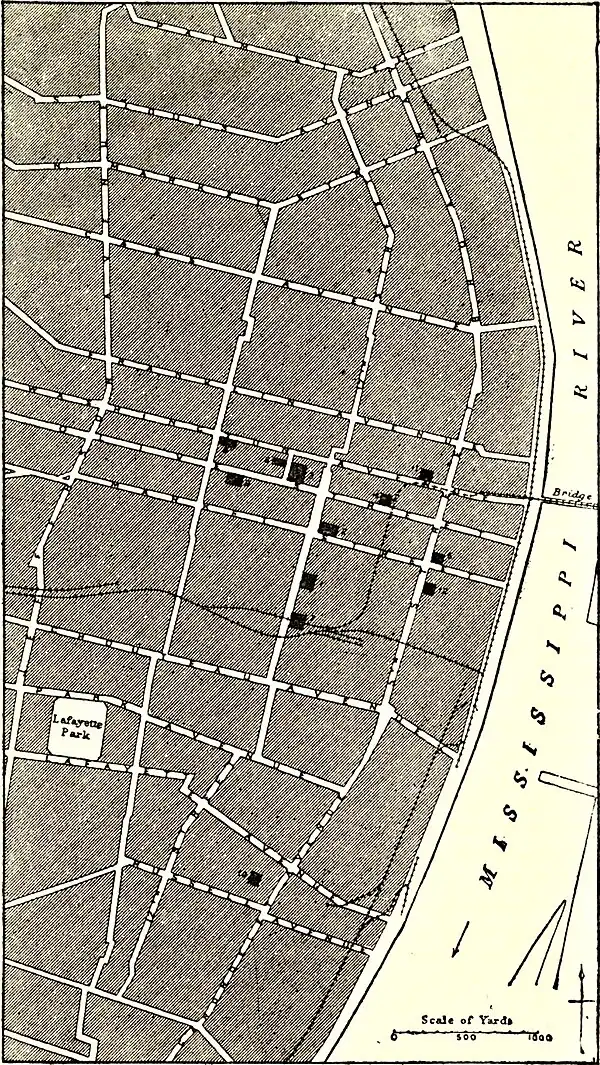
The plan of the
city is rectilinear, the ground being laid out in blocks about 300
feet square, with the general direction of
street lines north-south and east-west. The wharf or
river front is known as the Levee or Front
Street, the next
street west is Main
Street, and the next Second, and thence the
streets going north-south are, with few exceptions, in numerical order (Third, Fourth,
&c.). Fifth
Street has recently been named Broadway. The east-west
streets bear regular names (Chestnut, Pine,
Washington, Franklin, and the like). Market
Street is regarded as the middle of the
city, and the numbering on the intersecting
streets commences at that line, north and south respectively. One hundred house numbers are allotted to each block, and the blocks follow in numerical order. The total length of paved
streets in
St Louis is 316
miles, of unpaved
streets and
roads 427, total 743
miles. In the central
streets, subject to heavy traffic, the pavement is of
granite blocks; wood, asphalt, and limestone blocks and Telford pavements are also used. There are nearly 300
miles of macadamized
streets, including the roadways in the new limits. The length of paved alleys is about 66
miles. The
city has an extensive sewer system (total length 223
miles), and, owing to the elevation of the residence and business districts above the
river, the drainage is admirable. The largest sewer, Mill Creek (20
feet wide and 15
feet high), runs through the middle of the
city, from west to east, following the course of a stream that existed in earlier days. The water-supply is derived from the
Mississippi; the water is pumped into settling basins at Bissell’s Point, and thence into the distributing pipes, the surplus flowing to the storage reservoir on Compton Hill, which has a capacity of 60,000,000
gallons. The length of water-pipe is nearly 250
miles; the capacity of the low-service engines which pump the water into the settling basins is 56,000,000
gallons in twenty-four hours, and that of the high-service engines which supply the distributing system 70,000,000
gallons. The average
daily consumption in twenty-four hours is nearly 28,000,000
gallons. The works, which are owned by the
city, cost over $6,000,000. Among the more