Page:Downey•Quartz·Reefs·West·Coast•1928.pdf/28
30
The fourth belt is described as commencing at the ocean a little southward of the Paringa River. This belt contained the copper-ore found in the Thomas Range, and outcrops of quartz reefs in the spurs between the Paringa and Blue Rivers. Much of the country in this belt, was, however, practically inaccessible.
The fifth belt commenced a little to the northward of Arnott Point, and was believed by Mr. Douglass to be the same as the Shotover belt.
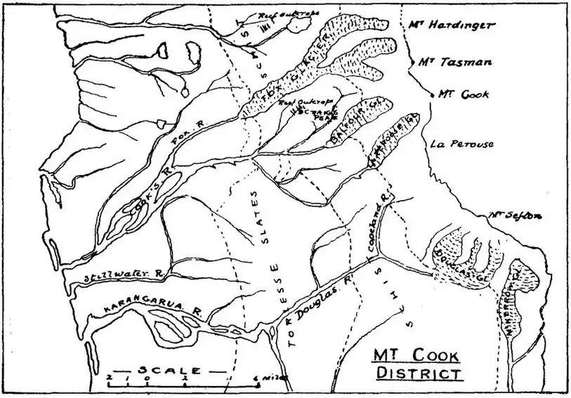
The sketch-map shown in Fig. 3 will serve to show the position of some of the reefs in the second belt described, but there are no plans available indicating the location of the other reefs or lodes mentioned. It may be said, however, that all the belts referred to are in schist country for the main part, and in New Zealand the experience has been that in this class of country reefs have been found not to carry their values to any great depth.
NELSON PROVINCE.
The Nelson Province, stretching from Cook Strait on the north to the Grey River on the south, and from the Tasman Sea to the crown of the dividing-range, has contained all the more important reefing fields in the West Coast District, and quartz deposits have been found scattered widely throughout it, most of the counties comprising it having possessed mines from which fair quantities of gold have been produced.
COLLINGWOOD COUNTY.
In Collingwood County, in the extreme north-west of the province, the principal quartz-mining localities were those known as Bedstead Gully and West Wanganui Inlet.